Wednesday, March 28, 2012

Howard's Lick/Jackson Home

Howard's Lick side of marker in Hardy County, WVHardy County, WV

Marker Text: Howard's Lick, (3 Mi. W.), or Lee White Sulphur Springs, was once owned by Gen. Henry "Light Horse Harry" Lee of Revolutionary War fame. It was owned later by Charles Carter Lee, brother of the beloved Gen. Robert E. Lee.
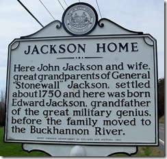
Jackson Home side of marker in Hardy County, WV(Reverse Side) Here John Jackson and wife, great-grandparents of Gen. "Stonewall" Jackson, settled about 1750 and here was born Edward Jackson, grandfather of the great military genius, before the family moved to the Buckhannon River.

Location: On WV Route 259, just north of Mathias, WV north of the turn off for Lost River State Park. Erected by the West Virginia Department of Culture and History in 1980.
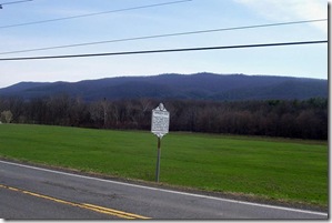
Jackson Home and Howard's Lick marker along Route 259 in Hardy Co. WV  Today's marker is about the intersection of the lives of Gen. Robert E. Lee and Thomas “Stonewall” Jackson among their families here in the Lost River Valley in Hardy County, WV.

  Thomas “Stonewall” Jonathan Jackson was the great-grandson of John Jackson and Elizabeth Cummins (also known as Elizabeth Comings and Elizabeth Needles). John Jackson was a Protestant who moved to the American Colonies from Coleraine, County Londonderry, Ireland. While living in London, he was convicted of the capital crime of larceny for stealing £170; the judge at the Old Bailey sentenced him to a seven-year indenture in America. Elizabeth, a strong, blonde woman over 6 feet (1.8 m) tall, born in London, was also convicted of larceny in an unrelated case for stealing 19 pieces of silver, jewelry, and fine lace, and received a similar sentence. They both were transported on the prison ship Litchfield, which departed London in May 1749 with 150 convicts. John and Elizabeth met on board and were in love by the time the ship arrived at Annapolis, Maryland. Although they were sent to different locations in Maryland for their indentures, the couple married in July 1755.

Saturday, March 24, 2012

Battle of Kernstown

Battle of Kernstown marker A-9 in Frederick Count, VAMarker No. A-9
Frederick County, VA

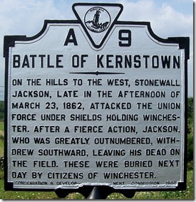
Marker Text: On the hills to the west, Stonewall Jackson, late in the afternoon of March 23, 1862, attacked the Union Force under Shields holding Winchester, after a fierce action, Jackson, who was greatly outnumbered, withdrew southward, leaving his dead on the field. These were buried next day by citizens of Winchester.

Location: West of U.S. Route 11 (Valley Pike), at the end of Opequon Church Lane, 5.3 miles north of Stephens City and just south of Winchester. Follow street signs for Opequon Presbyterian Church. Erected by Conservation & Development Commission in 1932.

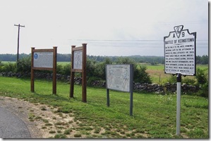
Battle of Kernstown marker A-9 grouped with three markers about battle

State historical marker is grouped with three other markers related to both first and second battles of Kernstown.  Background in photo is where main action of First Battle of Kernstown occurred.  Click any photo to enlarge.

  Yesterday was the 150th Anniversary of the First Battle of Kernstown, which is south of the city of Winchester, VA. The First Battle of Kernstown is connected to the Peninsula Campaign that Union Maj. General George B. McClellan was beginning in the area around Newport News, Yorktown and Williamsburg, VA in his attempt to capture Richmond, VA the Confederate capital. Confederate General Johnston moved his troops closer to Richmond for its defense and knowing that he would likely be outnumbered in comparison to the number of Union soldiers attacking Richmond, he needed to prevent additional Union troops from coming to assist McClellan's army. Johnston instructed Confederate Maj. General Thomas J. “Stonewall” Jackson, to develop plans to keep as many Union troops occupied in the Shenandoah Valley.

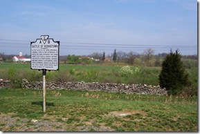
Battle of Kernstown marker A-9 with Pritchard Hill and Farm in the background.

Pritchard Farm in behind the marker in center of photo.

  The First Battle of Kernstown was fought on Sunday, March 23, 1862, in what would become the first battle of General Jackson's Valley Campaign of 1862 and the only battle he would lose as a commander during the Civil War. The devoutly religious Jackson preferred to avoid battles on the Sabbath, but throughout the Civil War he did not hesitate when military advantage could be gained. He later wrote to his wife:

  “I felt it my duty to [attack], in consideration of the ruinous effects that might result from postponing the battle until the morning. So far as I can see, my course was a wise one; the best that I could do under the circumstances, though very distasteful to my feelings; I hope and pray to our Heavenly Father that I may never again be circumstanced as on that day. I believe that so far as our troops were concerned, necessity and mercy both called for the battle.”

Monday, March 19, 2012

George Washington in Winchester

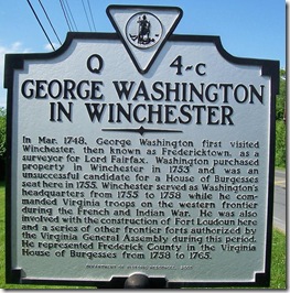
George Washington In Winchester, marker Q-4c in Frederick County, VAMarker No. Q-4-c
City of Winchester
Frederick County, VA

Marker Text:  In Mar. 1748, George Washington first visited Winchester, then known as Fredericktown, as a surveyor for Lord Fairfax. Washington purchased property in Winchester in 1753 and was an unsuccessful candidate for a House of Burgesses seat here in 1755. Winchester served as Washington's headquarters from 1755 to 1758 while he commanded Virginia troops on the western frontier during the French and Indian War. He was also involved with the construction of Fort Loudoun here and a series of other frontier forts authorized by the Virginia General Assembly during this period. He represented Frederick County in the Virginia House of Burgesses from 1758 to 1765.

Location: On U.S. Route 11 (Martinsburg Pike) north of intersection with Route 1322 (Brooke Road) northside of Winchester. Grouped with marker A-4 (Fort Collier). Erected by the Department of Historic Resources in 2005.

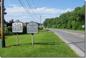
George Washington In Winchester with Fort Collier marker on northside of Winchester

Photo taken looking north on U.S. Route 11. Click any photo to enlarge.

  Winchester played an important role in George Washington's early adult life, as a surveyor and the development of his military and political career. At the age of sixteen, Washington came to Winchester to begin what he thought would be his life's profession, surveying. He came to what was then called Frederick Town (Winchester) in March 1748 as a surveyor for Lord Fairfax who lived in nearby Greenway Court at White Post. He spent the next 10 years experiencing many of his firsts in the area.

Saturday, March 17, 2012

Gauley Bridge

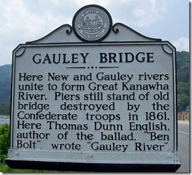
Gauley Bridge marker in Fayette County, WVFayette County, WV

Marker Text: Here New and Gauley rivers unite to form Great Kanawha River. Piers still stand of old bridge destroyed by the Confederate troops in 1861. Here Thomas Dunn English, author of the ballad, "Ben Bolt", wrote "Gauley River".

Location: On U.S. Route 60 in Gauley Bridge, West Virginia.

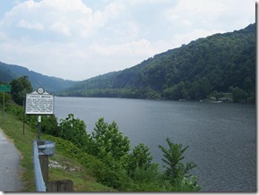
  Gauley Bridge is a small incorporated municipality in Fayette County located at the confluence of the Gauley and New Rivers, where the two streams join to form the Kanawha River. Gauley Bridge due to its geographic location serves as the eastern gateway to the Kanawha Valley.

Gauley Bridge marker along the Gauley River looking east  The town achieved notoriety during the Great Depression of the 1930s when hundreds of unemployed workers, many of them Southern blacks, swarmed into Gauley Bridge to take construction jobs. They served as labors on the construction of the nearby Hawks Nest dam and tunnel. The tunnel was driven three miles through Gauley Mountain, and tunnel workers almost immediately began to sicken and die. The cause was silicosis, a disease well known in Europe but not in the United States at that time. The death toll has been estimated at more than 750, making the Hawks Nest disaster among the worst industrial accidents in U.S. history.

  The name Gauley Bridge derived from the presence of a wooden covered bridge used to carry traffic across the Gauley River over the James River & Kanawha Turnpike which came through here beginning in the early 1820s. Gauley Bridge being the eastern gateway to the Kanawha Valley was of strategic importance during the Civil War.

Friday, March 16, 2012

Charlottesville General Hospital

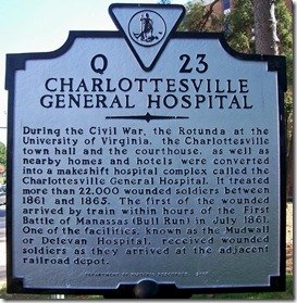
Charlottesville General Hospital, marker Q-23 Charlottesville, VAMarker No. Q-23
City of Charlottesville
Albemarle County, VA

Marker Text: During the Civil War, the Rotunda at the University of Virginia, the Charlottesville town hall and the courthouse, as well as nearby homes and hotels were converted into a makeshift hospital complex called the Charlottesville General Hospital. It treated more than 22,000 wounded soldiers between 1861 and 1865. The first of the wounded arrived by train within hours of the First Battle of Manassas (Bull Run) in July 1861. One of the facilities, known as the Mudwall or Delevan Hospital, received wounded soldiers as they arrived at the adjacent railroad depot.

Location: At the intersection of West Main Street (Business U.S. 250) and 13th Street and near Jefferson Park Avenue between the University Medical Center and the campus of the University of Virginia. Erected by the Department of Historic Resources in 2000.

  Traveling throughout Virginia, you will find countless markers and monuments dedicated to the American Civil War and most of these markers are related to some battle or military engagement which occurred at the location. Virginia had more military actions within its borders than any other state. You will also come across other markers related to the Civil War, but not just about battles. These markers told other stories about the Civil War, such as, about hospitals, (like today's markers), churches that served as hospitals, cemeteries, camps, and other locations related to some aspect of the war.

  Following the First Battle of Manassas or Bull Run occurring during July, 1861 the need for hospitals for the Confederate Army were needed and Charlottesville was a logical location. Charlottesville was connected to Manassas Junction by railroad and made the transportation of wounded soldiers easier and would get them far enough outside the field of action.

Tuesday, March 13, 2012

Lincoln's Virginia Ancestors

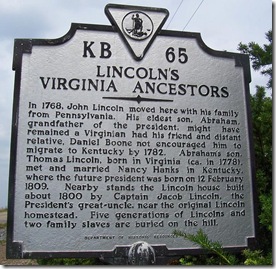
Lincoln's Virginia Ancestors Marker KB-65 Rockingham Co., VAMarker No. KB-65
Rockingham County, VA

Marker Text: In 1768, John Lincoln moved here with his family from Pennsylvania. His eldest son, Abraham, grandfather of the president, might have remained a Virginian had his friend and distant relative, Daniel Boone not encouraged him to migrate to Kentucky by 1782. Abraham's son, Thomas Lincoln, born in Virginia (ca. in 1778), met and married Nancy Hanks in Kentucky, where the future president was born on 12 February 1809. Nearby stands the Lincoln house built about 1800 by Captain Jacob Lincoln, the President's great-uncle, near the original Lincoln homestead. Five generations of Lincolns and two family slaves are buried on the hill.

Location: Near Linville, Virginia on Virginia Route 42 (Harpine Highway) on the east side of road, next to what looks like an older section of Route 42. Erected by the Department of Historic Resources in 1997.

Lincoln's Virginia Ancestors Marker KB-65 Rockingham Co., VA  Today's marker is the companion marker to A-18 (Abraham Lincoln's Father), I posted on March 10, 2012. This marker is located near where the old Lincoln homestead stood. What does remain is a Lincoln family home built around 1800 and the old Lincoln family cemetery is nearby on the hill.

  President Abraham Lincoln's grandfather, whom the future president was named, Abraham Lincoln moved with his parents, John and Rebecca Lincoln from Pennsylvania in 1768. Abraham Lincoln was born 13 May 1744 in what is now Berks County, Pennsylvania. Abraham was the first child born to John and Rebecca Lincoln, who had nine children in all: Abraham born 1744, twins Hannah and Lydia born 1748, Isaac born 1750, Jacob born 1751, John born 1755, Sarah born 1757, Thomas born 1761, and Rebecca born 1767.

Sunday, March 11, 2012

Earliest Church

Earliest Church marker in Stanford, KY (Click any photo to Enlarge)Lincoln County, KY
Marker Number 1234

Marker Text: The Stanford Presbyterian Church, founded 1788 on this site, on Old Wilderness Trail. Land given by Mary Briggs, sister of Gen. Benjamin Logan. Church moved to its present site, 1838; land given by Logan, one of founders. In 1797, David Rice, father of Presbyterianism in Kentucky, preached here. The original log church now part of this library building.

Location: On Main St. in front of the Old Presbyterian Meeting House and Museum, Stanford, Kentucky (U.S. Routes 27 & 150). Erected by the Kentucky Historical Society, Kentucky Department of Highways in 1969.

Earliest Church marker in Stanford, KY in front of Old Presbyterian Meeting House  I have not posted a marker about a church for a few months and today's marker is about a church I came across in Stanford, Kentucky last May. As you can see from the photos below this marker is next to a building as a part of the Lincoln County History Museum and within the walls of this building are the original log walls of what is probably Kentucky's oldest remaining church building. I was told that the Stanford Presbyterian congregation does conduct worship at this site about once a year to remind the congregation of its early roots in the community.

  The first recorded evidence of a congregation of Presbyterians in Stanford, Kentucky is from the minutes of Transylvania Presbytery meeting at Paint Lick in 1788. By order of the Presbytery, the Rev. McConnell was commissioned to preach two Sundays each month in the vicinity of the Stanford Courthouse for the congregation there.

Saturday, March 10, 2012

Abraham Lincoln's Father

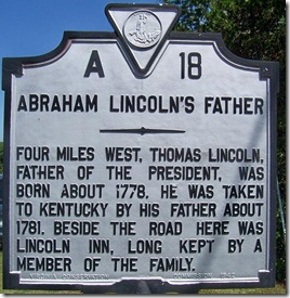
Abraham Lincoln's Father Marker A-18 in Rockingham Co. VAMarker No. A-18
Rockingham County, VA

Marker Text: Four miles west, Thomas Lincoln, father of the President, was born about 1778. He was taken to Kentucky by his father about 1781. Beside the road here was Lincoln Inn, long kept by a member of the family.

Location: On U.S. Route 11 (Valley Pike), north of Lacey Spring and Lacey Spring Road. Erected by the Virginia Conservation Commission in 1942.

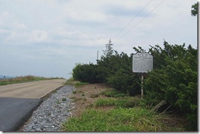
  Today's marker has a companion marker with different text located at the site mentioned in this marker, four miles west. This marker was erected in 1942, about the birthplace of Abraham Lincoln's father. Then, in 1997, a marker on Route 42 was placed in front of the location where Thomas Lincoln was born and his family and later generations of Lincoln's lived. (I will post this marker in a few days). I found that many early historical markers were originally located on main highways even when they were miles away from the actual location mentioned in the markers.

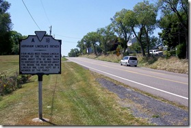
Abraham Lincoln's Father Marker A-18 looking south on Route 11

Photo taken looking south on U.S. Route 11.  Click any photo to enlarge.

  Early markers, as are current markers, were used by the state to promote tourism and this was best done by placing the marker on a major road, such as, U.S. Route 11 or the Great Wagon Road or Valley Pike as it was been called. In 1942, the road at the actual site was probably not well developed and not a road that a tourist would normally travel. Today, Route 42 is a four lane highway and more accessible. U.S. Route 11 where this marker is located was the major highway through the Shenandoah Valley in the early years of automobile travel in Virginia.

Friday, March 9, 2012

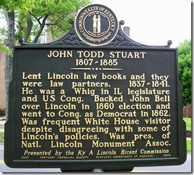
John Todd Stuart, 1807-1885

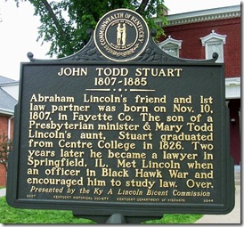
John Todd Stuart marker in Danville, Kentucky at Centre College (Side 1)Boyle County, KY
Marker Number 2244

Marker Text: Abraham Lincoln’s friend and 1st law partner was born on Nov. 10, 1807, in Fayette Co. The son of a Presbyterian minister & Mary Todd Lincoln’s aunt, Stuart graduated from Centre College in 1826. Two years later he became a lawyer in Springfield, IL. Met Lincoln when an officer in Black Hawk War and encouraged him to study law. Over.

John Todd Stuart marker in Danville, Kentucky at Centre College (Side 2)(Reverse) Lent Lincoln law books and they were law partners, 1837–1841. He was a Whig in IL legislature and US Cong. Backed John Bell over Lincoln in 1860 election and went to Cong. as Democrat in 1862. Was frequent White House visitor despite disagreeing with some of Lincoln’s policies. Was pres. of Natl. Lincoln Monument Assoc. Presented by the Ky A. Lincoln Bicent Commission

Location: On Main Street, Danville, KY across the street from Danville Presbyterian Church and in front of Stuart Hall on Centre College campus. Erected by the Kentucky Historical Society, Kentucky Department of Highways in 2007.

  Today's marker is about a man who was a friend and law partner of Abraham Lincoln. I have read many historical accounts of Lincoln over the years and there are many things to admire about Lincoln and his place as one of the most respected U.S. President's is well deserved. One characteristic of Lincoln, I have come to admire is his ability to surround himself with people who did not hold the same opinions or viewpoint about the nation and politics as he held. This ability to maintain friendships with people who held different views, I believe made him a stronger leader. I believe our current political climate in the U.S. could be enriched and learn from Lincoln's prospective rather than only surrounding ourselves with people who hold the same viewpoints. I know I have benefited through conversations I have had with people who hold a different view than mine.

  As you read this marker, it makes a person wonder what if Lincoln had never met Stuart, would Abraham Lincoln had become the U.S. President? What if, in fact, he had never entered into politics or law and had simply become a...blacksmith? According to Lincoln's bio this might have happened had it not been for John Todd Stuart. If not for Stuart's influence, it is conceivable that Lincoln might never have been interested in the law - and thus, might not ever have become president.

Wednesday, March 7, 2012

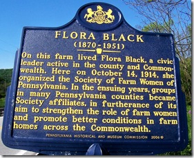
Flora Black (1870-1951)

Flora Black Marker in Somerset County, PASomerset County, PA

Marker Text: On this farm lived Flora Black, a civic leader active in the county and Commonwealth. Here on October 14, 1914, she organized the Society of Farm Women of Pennsylvania. In the ensuing years, groups in many Pennsylvania counties became Society affiliates, in furtherance of its aim to strengthen the role of farm women and promote better conditions in farm homes across the Commonwealth.

Location: On U.S. Route 219, three miles northwest of Meyersdale, PA.  Erected by the Pennsylvania Historical and Museum Commission in 2006. Note: This marker may have been a replacement for an earlier marker dedicated in 1989.
"Being it is necessary and advisable to perpetuate that which was good in the pioneer homes of our grandmothers; and to preserve their spirit of patriotism and sacrifice; to foster a love for the farm and rural life of today; to uphold the dignity of farming, to teach the responsibility that lies in working the soil; to enhance the charm of a real country home; therefore to create and maintain organized groups to accomplish these ends, we, the Society of Farm Women of Pennsylvania, do associate ourselves together and adopt this constitution" Preamble, Official Bylaws and Constitution, Society of Farm Women, 1951.
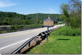
Flora Black Marker along Route 219 in Somerset County, PA
Photo taken looking north on Route 219.  Click any photo to enlarge.

  Flora Snyder was born in Somerset, PA on February 20, 1870. As a girl growing up in rural Pennsylvania, she helped her mother and learned the skills necessary to be a good wife and mother. After attending schools in Somerset, Snyder went to the Maryland College for Women. In 1883, she married Franklin B. Black and assumed the duties of a rural wife and mother of four children. She applied the knowledge she learned as a youngster to keep her family's home. She did miss the social networks she had experienced during her college years. Mrs. Black became convinced that farm women should also have time to get together for "fun and learning."

Saturday, March 3, 2012

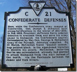
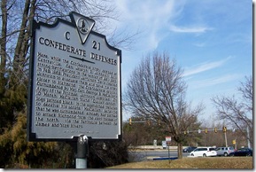
Confederate Defenses

Confederate Defenses Marker C-21 Fairfax Co. VAMarker No. C-21
Fairfax County, VA

Marker Text: Here, while the Confederate army camped at Centreville, Gen. Joseph E. Johnston built strong fortifications in the winter of 1861-1862. In Feb. 1862, President Jefferson Davis ordered Johnston to evacuate them and move his army closer to Richmond, the Confederate capital. Outnumbered by Maj. Gen. George B. McClellan's Army of the Potomac, Johnston complied. On 10 March, McClellan found "Quaker cannon," logs painted black, in the abandoned trenches to deceive his scouts. McClellan, believing that he was outnumbered, already had planned to attack Richmond from the east instead of the north, via the Peninsula between the James and York Rivers.

Location: At the intersection of Machen Road and U.S. Route 29 (Lee Highway) on the grounds of the Centreville Public Library located at the southwest corner of the intersection at 14200 Saint Germain Drive, Centreville VA 20120. Grouped with three other markers, C-20 (First Battle of Manassas); C-22 (Second Battle of Manassas); and C-40 (Campaign of Second Manassas). Erected by the Department of Historic Resources in 1999.

Confederate Defenses Marker C-21 Route 29 in the background  Over the next few months I will be returning to posting markers I have related to the American Civil War. During the winter months most military activities slow down and the armies made camp in different locations. Today's marker is about the winter quarters and defenses of the Confederate Army under the command of Gen. Joseph E. Johnston. Little today remains of these defenses and the camp during the winter of 1861-62. Most of the area has been developed since the 1960's and most traces of the actions of the Civil War in this area are only remnants. At this link The Historical Marker Database has some photos of the remnants of these fortifications that exist today. This marker replaces an older marker from the 1920's or 30's and was originally located on the highway which is now Route 29.

Friday, March 2, 2012

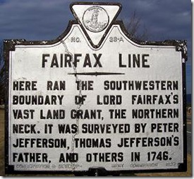
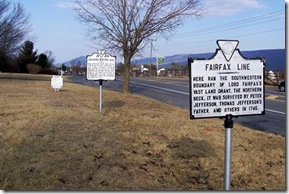
Fairfax Line

Fairfax Line Marker A-36 in Shenandoah County, VAMarker No. A-36
Shenandoah County, VA

Marker Text: Here ran the southwestern boundary of Lord Fairfax's vast land grant, the Northern Neck. It was surveyed by Peter Jefferson, Thomas Jefferson's father, and others in 1746.

Location: On U.S. Route 11 (Old Valley Pike), south of New Market at the Shenandoah/ Rockingham County Line. Grouped with two other markers, A-34 (Sevier's Birthplace) and Z- (Shenandoah/Rockingham County). Erected by the Conservation & Development Commission in 1927.

  When I lived in West Virginia, there was a church member who was a surveyor and I use to have some interesting discussions about his survey work. I don't claim to understand a great deal about the work of surveying. In one of our discussions he spoke about the Fairfax Line and I only understood a little of what he said. I remember his talking about the Fairfax Stone which is located at the headwaters of the Potomac River where Maryland's border dips down into West Virginia where it forms a point.

Fairfax Line Marker A-36 in Shenandoah County, VA

Photo taken looking north toward the town of New Market, Virginia.  Route 11 is on the right.  Click any photo to enlarge.

  What I came to understand is that in the world of surveying, the “Fairfax Line” is one of the more interesting surveys in history. The survey was conducted in order to establish the limits of the Northern Neck land grant in Virginia, which was inherited by Thomas, sixth Lord Fairfax who eventually lived in Greenway Court in Clarke County, VA.

Thursday, March 1, 2012

The McDowell Family of Virginia and Kentucky

Post Summary

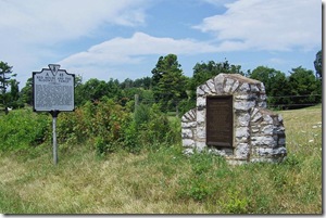
McDowell Family markers in Rockbridge Co. Virginia  I have now posted over 100 state historical markers on this blog since it began. I have photos of over 1600 markers, I could potentially post in the future. I am always taking more photos each year.

  Whenever you read an historical marker, it can only tell you limited information nor can it relate all the significant historical facts about a specific location or person. This is one of the reasons I started this blog, because I became interested about learning more and discover additional details about the history shared by these markers. After I stopped to photograph about a hundred or more markers, I began realizing that these markers were not just isolated moments in history, but several markers in different locations were telling a larger story of individuals, families, states or a nation, many times across several states. I wanted to take a moment to point out this larger story by periodically listing prior posts that relate to a common topic or group.

  During November and December, I had nine posts related to the family of Dr. Ephraim McDowell whose family first settled in Virginia and parts of the family later moved to Kentucky.

Red House and the McDowell Family

McDowell's Grave

Cherry Grove Estate

Site of Log Courthouse

Grayson's Tavern

Dr. Alexander Humphreys

Ephraim McDowell House

Jane Todd Crawford

Dr. Ephraim McDowell 1771-1830
McDowell-Crawford Surgery