Sunday, December 16, 2012

Capt. John "Jack" Jouett, Jr.

Capt. John "Jack" Jouett Jr. marker 1528 in Bath County, KY (Click any photo to enlarge)Bath County, KY
Marker Number 1528

Marker Text: This famous Revolutionary War hero, who rode 40 miles to warn Jefferson, Patrick Henry and other legislators of British approach, June 3, 1781, is buried in Bath Co. Jack Jouett of Va. galloped all night from Cuckoo Tavern to Monticello to Charlottesville. Moved to Kentucky, 1782. Represented Mercer County in Va. Assembly, and Mercer and Woodford counties in Ky. Assembly.

Location: In Owingsville, KY on the Bath County Courthouse lawn, near the intersection with U.S. Route 60 and KY Route 36. Grouped with Marker No. 940 (Bath County). Erected by the Kentucky Historical Society, Kentucky Department of Transportation in 1975.

  Today's marker is the final marker in my eight marker series about the Ride of Jack Jouett from Cuckoo to Charlottesville, VA. Until I take more photos about Jouett, I know about two more historic markers, which exist in Kentucky.
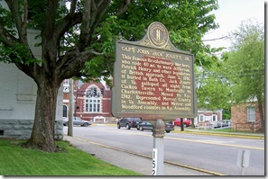
Capt. John "Jack" Jouett Jr. marker 1528 with U.S. Route 60 in the background.  A year after Jouett's ride to warn the Virginia Legislative in Charlottesville. Jack Jouett in 1782 moved to what is now Kentucky, then it was in Virginia. A Jouett family story says that, on his way to Kentucky, Jack and his companions were moving westward through the Cumberland Gap along Daniel Boone’s Wilderness Road when they heard the screams of a woman coming from a lonely cabin. Jouett burst into the house and found a wife being abused by her husband. He attempted to intervene by knocking down the husband, but the wife did not appreciate his involvement and the lady reached for a longhandled frying pan and hit Jouett over the head so forcefully that the bottom of the pan was knocked out and the rim driven down around his neck. Jouett fled the scene and travelled 35 miles before he found a blacksmith to remove the pot.

  Undiscouraged, Jouett settled down in Harrodsburg, Kentucky (then Virginia) in Mercer County and entered politics, serving as a Virginia state legislator. He helped Kentucky break free from Virginia and become a independent state and served four terms in the new legislature from both Mercer and Woodford Counties. Jouett was a prominent citizen of Kentucky. He had friendships with Andrew Jackson and Henry Clay. In business, he pioneered livestock breeding in Woodford County and importing fine horses and cattle from England.

Saturday, December 15, 2012

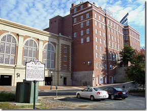
Dr. William Fleming

Dr William Fleming, marker A-64 in Staunton, VA (Click any photo to enlarge)City of Staunton, VA
Marker No. A-64

Marker Text: Physician, soldier, and statesman, Dr. William Fleming (1728-1795) studied medicine in his native Scotland before practicing in Staunton from 1763 to 1768. His home stood at the crossing of New Street and Lewis Creek. Dr. Fleming's career included periods as commander of the Botetourt Regiment, Commissioner for Kentucky, member of the Continental Congress, delegate to the Virginia Constitutional Convention, and Acting Governor when the Virginia General Assembly met in Staunton in June, 1781.

Location:  At the intersection of Routes 250 & 11 (Greenville Avenue and South New Street next to a City of Staunton parking lot. Erected by the Department of Conservation and Historic Resources in 1987.

  Colonel William Fleming was a physician, soldier, statesman, and planter who briefly served as acting Governor of Virginia during the American Revolutionary War. Fleming was born in Jedburgh, Scotland in 1728, to Leonard and Dorthea Fleming. He studied medicine and trained as a physician at the University of Edinburgh and then entered the Royal Navy, serving as a surgeon's mate. While in the service, he was captured and imprisoned by the Spanish. After his release, he resigned from the navy and decided to emigrate to Virginia in the early 1750's.

Dr. William Fleming, marker A-64 near the Stonewall Jackson Hotel.

Photo taken with Greenville Avenue in the background along with the Stonewall Jackson Hotel.  Click any photo to enlarge.

  William Fleming arrived in Virginia in time to participate in several engagements of the French and Indian War as a surgeon. He was a lieutenant on the 1756 Sandy Creek expedition. Then he was appointed ensign in George Washington’s First Virginia Regiment and served as a surgeon in the Forbes expedition and in the Anglo-Cherokee War. He served in two more campaigns in 1758 and was then made a captain and stationed in Staunton in 1760.

  During his time stationed in Staunton he apparently met and married Israel Christian’s daughter, Anne, in 1763. Israel Christian was a prominent Augusta County citizen, a House of Burgesses member and an Irish immigrant. After marrying Anne Christian, they settled here in Staunton in a house located near the approximate site of this marker, which is where Lewis Creek meets New Street. Fleming resumed his medical career by setting up a doctor’s office and performing surgery in Staunton.

Friday, December 14, 2012

Trinity Church

Trinity Church marker QC-1 in Staunton, VA - Augusta County.City of Staunton, VA
Marker No. QC-1

Marker Text: Known originally as Augusta Parish Church, it was founded in 1746 as the County Parish. The Virginia General Assembly met here in June 1781 to avoid capture by British Raiders. The present church was erected in 1855 and was used by the Virginia Theological Seminary during the War Between the States. The first Bishop of Virginia, James Madison, was a member of this church.

Location: On 214 West Beverley Street in the City of Staunton in front of the church. Erected by the Virginia State Library in 1962.

  After the legislators quick escape from Charlottesville after the timely warning by Jack Jouett, they traveled over the Blue Ridge Mountains to the city of Staunton about 40 miles further west.  The Virginia legislature reconvened a few days later and met here between June 7-23, 1781 at Trinity Church in Staunton, making the first Augusta Parish Church (which was its name then) serve as the Virginia state capitol for sixteen days. A Windsor chair, used in that meeting is on display in the corner of St. Columba's Chapel within the current church building.

Trinity Church marker QC-1 in front of Trinity Church in Staunton, VA (Click any photo to enlarge)  The General Assembly of Virginia was deeply appreciative of the debt they owed as a legislature and personally to Jack Jouett, so on June 15, while meeting here at Trinity Church it adopted the following resolution:

  Resolved: That the executive be desired to present to Captain John Jouett an elegant sword and pair of pistols as a memorial of the high sense which the General Assembly entertain of his activity and enterprise in watching the motions of the enemy’s cavalry on their late incursion to Charlottesville and conveying to the assembly timely information of their approach, whereby the designs of the enemy were frustrated and many valuable stores preserved.

  Jouett was given the pistols in 1783, but it was twenty years before he received the “elegant sword.” By that time he had made quite a name for himself beyond the Alleghenies, in present-day Kentucky.

  Trinity Church, the oldest church in Staunton and known for its first eighty years as “Augusta Parish,” was founded in 1746, one year after Augusta County became an independent entity, and one year before the City of Staunton was established.

Thursday, December 13, 2012

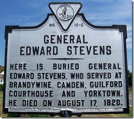
General Edward Stevens

General Edward Stevens - G-10 in Culpeper County, VACulpeper County, VA
Marker No. G-10

Marker Text: Here is buried General Edward Stevens, who served at Brandywine, Camden, Guilford Courthouse and Yorktown. He died on August 17, 1820.

Location: On Route 229 at northern entrance to Culpeper in front of the Masonic Cemetery. Erected by the Conservation & Development Commission in 1927.

  At first glance, you might wonder why I would be including today's marker among my “Jack Jouett” series of historical markers. The simple text of this marker erected in 1927, which is among the group of earliest markers erected in Virginia tells you nothing about Jack Jouett, but Edward Stevens owes a great deal to Jouett.

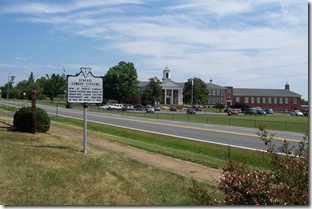
General Edward Stevens - G-10 on Route 229 north of Culpeper, VA (Click any photo to enlarge)

Photo taken looking north on Route 229. Culpeper Co. School in the background. Click any photo to enlarge.

  Edward Stevens was born in Culpeper County, Virginia and joined the colonial forces fighting England early during the American Revolution. In December 1775, Stevens commanded a battalion of Virginia militia at the Battle of Great Bridge. The battle, a victory for the Americans, prevented then Lord Dunmore, the Royal Governor of Virginia, from retaking the state for England.

  Edwards did not remain in the Virginia militia. He was commissioned a colonel in the 10th Virginia Regiment in Continental Army in November 1776. Edwards and his regiment fought at the Battles of Brandywine and Germantown. He served less than two years in the American army, resigning in January 1778. Edwards did continue to serve Virginia. He was appointed brigadier general of the Virginia militia in 1779.

Wednesday, December 12, 2012

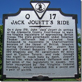
Jack Jouett's Ride

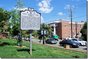
Jack Jouett's Ride - Q-17 in Charlottesville, VA (Click any photo to enlarge)Charlottesville, VA
Marker No. Q-17

Marker Text: On 4 June 1781, John "Jack" Jouett Jr. arrived at the Albemarle County Courthouse to warn the Virginia legislature of approaching British troops. The state government under Governor Thomas Jefferson had retreated from Richmond to reconvene in Charlottesville because of the threat of British invasion during the Revolutionary War. Jouett had spotted Colonel Banastre Tarleton and his 180 dragoons and 70 cavalrymen 40 miles east at Cuckoo Tavern, and rode through the night to reach here by dawn. Jouett's heroic ride, which allowed Jefferson and all but seven of the legislators to escape, was later recognized by the Virginia General Assembly, which awarded him a sword and a pair of pistols.

Location: At the corner of High and Park Streets, Courthouse Square at rear of the Albemarle County Courthouse. Erected by the Department of Historic Resources in 1998.

Jack Jouett's Ride - Q-17 as seen along High Street, Charlottesville, VAPhoto taken with High Street in the background. Marker on northeast corner of the courthouse square.  Click any photo to enlarge.

  We continue our series of markers about Jack Jouett's ride from Cuckoo to Charlottesville with the marker indicating his arrival in Charlottesville and this marker is located in the Albemarle County Courthouse square.

  Upon reaching Thomas Jefferson's home at Monticello about 4:30 a.m. on June 4, 1781, Jouett proceeded at once to rouse the sleeping occupants. Among them, besides Jefferson, were the Speakers and other members of the two houses of the General Assembly. Jefferson not only thanked Jouett for his timely warning: but is understood to have tendered a bracing glass or two of his best Madeira. Refreshed, the rider mounted his horse and rode the remaining two miles to Charlottesville, where he awakened dozens more of Virginia's legislators, many at Swan's Tavern which once stood just about 150 feet south and across the street from this marker and was owned by Jack Jouett's father.

  Jefferson apparently took Jouett's warning seriously, but thought he had ample time to get away. Jefferson enjoyed breakfast along with other legislators staying at Monticello, then his guests joined their colleagues in town. Jefferson sent his family to safety at Enniscorthy Plantation fourteen miles away, via Blenheim, the Carter estate. He then spent nearly two hours securing and sorting his important state papers for packing or destruction. Technically, Jefferson was no longer Virginia's governor, his term had expired June 2. The government, however, would not appoint his replacement, General Nelson, until the fifth, and Nelson would not take office until the twelfth.

Tuesday, December 11, 2012

Castle Hill

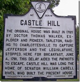
Castle Hill - W-204 in Albemarle County, VA in Jack Jouett marker series.Albemarle County, VA
Marker No. W-204

Marker Text: The original house was built in 1765 by Doctor Thomas Walker, explorer and pioneer. Tarleton, raiding to Charlottesville to capture Jefferson and the legislature, stopped here for breakfast, June 4, 1781. This delay aided the patriots to escape. Castle Hill was long the home of Senator William Cabell Rives, who built the present house.

Location: On Route 231 (Gordonsville Road), two miles northwest of Cismont. Erected by the Conservation & Development Commission in 1928.

  Today, we pick up the story of Jack Jouett and his ride from Cuckoo to Charlottesville here at Castle Hill.

  After leaving Cuckoo, VA and after Jack Jouett began his horseback ride toward Charlottesville. About an hour later at 11 p.m. on June 3, 1781, Tarleton paused for a three hour rest near the Louisa County Courthouse. He began his march again at about 2 a.m. He soon encountered a train of 11 or 12 supply wagons at Boswell's Tavern bound for South Carolina where Nathanael Greene led the main branch of the Continental Army in the South. Tarleton decided to burn the wagons rather than take them, in order, to prevent any further delay and continued forward.

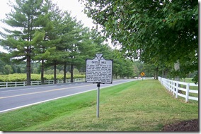
Castle Hill - W-204 along Route 231, Albemarle County, VA

Photo taken looking south on Route 231.  Click any photo to enlarge.

  Just before dawn on June 4, Tarleton reached the plantations of Castle Hill, (about 12 miles from Charlottesville) Doctor Thomas Walker's home, and a splinter group of British arrived at Belvoir, the home of his son, Continental Congress member John Walker. Tarleton captured or paroled various important figures at the two plantations. Various legends have sprung up about the stop at Castle Hill.

  The principal story says that Dr. Walker cunningly offered Tarleton an elaborate breakfast, the consumption of which so delayed the British Dragoons, that Jack Jouett had the needed time to beat Tarleton to Monticello and Charlottesville. Another legend has British dragoons stealing, one after the other, two breakfasts which had been prepared for their commander and Dr. Walker telling Tarleton that he would have to post a guard on the kitchen if he desired nourishment. This was done, the story continues and the cook finally served the third breakfast to the Colonel intact.

Monday, December 10, 2012

Jack Jouett's Ride

Jack Jouett's Ride marker W-213 in Lousia County, VALouisa County, VA
Marker No. W-213

Marker Text: From the tavern that stood here, Jack Jouett rode to Charlottesville, by the Old Mountain Road, in time to warn the members of the Virginia government of the coming of Tarleton's British cavalry, June 3, 1781.

Location: On U.S. Route 33, near intersection with Route 522 in Cuckoo. Marker is grouped with marker W-223 (Cuckoo). Erected by the Virginia State Library in 1963.

  Today's marker is the second in a series of eight markers about the ride of Jack Jouett from Cuckoo to Charlottesville, VA. Before Jack Jouett enters the story there is some back story leading up to this event.

  On June 1, 1781, British General Cornwallis learned from a captured dispatch that Virginia Governor Thomas Jefferson and Virginia's Legislature had fled to Charlottesville, Virginia, where Jefferson's home, Monticello is located. The American traitor Benedict Arnold, by this time had become a British general and his troops had been raiding and pillaging along the James River from the river’s mouth to Richmond, VA the state capitol. Virginia's legislature voted to move the government temporarily to Charlottesville to escaped Benedict Arnold's efforts to capture them.

Jack Jouett's Ride marker W-213 next to the "Cuckoo" marker on Route 522 & 33.

Photo taken looking north on Route 522 and east on Route 33. Click any photo to enlarge.

  General Cornwallis ordered Lieutenant Colonel Banastre Tarleton to ride to Charlottesville, VA and capture Gov. Jefferson and the Virginia legislature. Tarleton hoped to capture Jefferson and many notable Revolutionary leaders who were Virginia legislators, including: Patrick Henry, Richard Henry Lee, Thomas Nelson, Jr., and Benjamin Harrison V. Tarleton's ability to capture these Revolutionary leaders in Virginia would have been a major blow to the fight for independence and might have ended the Revolutionary War in favor of the British.

Sunday, December 9, 2012

Cuckoo

Cuckoo marker W-223 in Lousia County, VA (Click any photo to enlarge)Louisa County, VA
Marker No. W-223

Marker Text: Cuckoo, long a landmark for travelers, was built for Henry Pendleton about 1819. Nearby once stood the Cuckoo Tavern, from which in 1781 Jack Jouett made his famous ride. The Pendletons, a prominent family of physicians whose descendants still own the house, constructed two doctor's offices at Cuckoo that still stand; one was built in the 18th century and one in the 19th. The house retains many Federal-style details as well as an early-20th-century Colonial Revival portico. Cuckoo was listed on the National Register of Historic Places and the Virginia Landmarks Register in 1994.

Location: On Route 33 near intersection with Route 522 in Cuckoo. Marker is grouped with marker W-213 (Jack Jouett's Ride). Erected by the Department of Historic Resources in 1996.

  Today, I am starting as series of blog posts about eight historical markers related to a often overlooked historical event during the American Revolution. A few years ago I decided to drive U.S. Route 33 while traveling back home from Williamsburg, VA. I came across two markers in the little village of Cuckoo, VA. What I discovered was the story of Jack Jouett. Next to this marker about “Cuckoo” was a marker titled, “Jack Jouett's Ride.” I had never heard of Jack Jouett and about his night time ride 40 miles to Charlottesville, VA to warn the Virginia state legislative that the British were coming.

  Until I came across this, I don't ever remember hearing this story about Jack Jouett which begin here in Cuckoo. In school, we have all heard of the story of Paul Revere and his ride to warn the colonists about the approaching British at the beginning of the American Revolution. Unless you grew up in this part of Virginia where the story is told within the local schools, most of us have probably never heard of Jack Jouett and his ride in the closing months of the American Revolutionary War in 1781.

Cuckoo marker W-223 grouped with Jack Jouett's Ride marker in Lousia County, VA

Photo taken looking north on Route 522 and west on Route 33.  Click any photo to enlarge.

  In Cuckoo, VA there are two state historical markers, today's called “Cuckoo” deals chiefly about the village and the Pendleton family who were a family of physicians and the marker titled, “Jack Jouett's Ride,” which I will post tomorrow. The village of Cuckoo is directly east of Charlottesville and eight miles southeast of Lousia, VA on U.S. Route 33.

  Before the Pendleton's built the home pictured here in Cuckoo, there was a tavern nearby called “Cuckoo Tavern” where it is reported Jack Jouett's adventure began. Legend has it that the name Cuckoo came from a cuckoo clock that was in the tavern and the first such clock in this part of Virginia. While other sources state, it was not unusual for taverns to be named for animals, particularly birds. This might be the case, since Jack Jouett's father once owned Cuckoo Tavern and later owned another tavern in Charlottesville, VA called Swan Tavern. I will get into the details about Jack's ride tomorrow, but we will first deal with the marker called Cuckoo.

Saturday, December 8, 2012

Fredericksburg Campaign

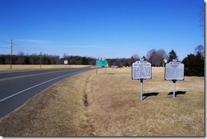
Fredericksburg Campaign, marker N-4 in Stafford County, VAStafford County, VA
Marker No. N-4

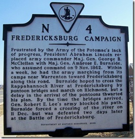
Marker Text: Frustrated by the Army of the Potomac's lack of progress, President Abraham Lincoln replaced army commander Maj. Gen. George B. McClellan with Maj. Gen. Ambrose E. Burnside, who assumed command on 9 Nov. 1862. Within a week, he had the army marching from its camps near Warrenton toward Fredericksburg along this road. Burnside hoped to cross the Rappahannock River at Fredericksburg by pontoon bridges and march on Richmond, but a delay in the arrival of the pontoons thwarted his plan. By the time the bridges arrived, Gen. Robert E. Lee's army blocked his path. Burnside forced a crossing of the river on 11 Dec. but was defeated two days later at the Battle of Fredericksburg.

Location: On Route 17, south of Route 654. Grouped with two other markers, E-85 (Civilian Conservation Corps – Company 2363) and N-6 (The Mud March). Erected by the Department of Historic Resources in 2002.

“It is well that war is so terrible, otherwise men should grow too fond of it.” Comment as I remember it made to General James Longstreet by Confederate General Robert E. Lee, on seeing a Federal charge repulsed in the Battle of Fredericksburg on Dec. 13, 1862.

The above quote is one I heard many years ago and always thought it was appropriate to any war and as I learned was quite appropriate to the U.S. Civil War.  I don't have many historic markers about the Battle of Fredericksburg, which is approaching its 150th anniversary.  I have attempted during trips to the area to take photo, but I found Fredericksburg traffic quite congested and not knowing my way around I took photos of some unrelated markers and landmarks. You can find photos and information about most of the historical markers in Fredericksburg, VA by following this link to The Historical Markers Database web site.

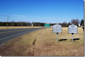
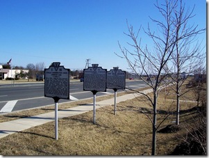
Fredericksburg Campaign marker N-4 is the middle marker.

Photo taken looking south on U.S. Route 17 toward Fredericksburg.  Marker is the middle one.  Click any photo to enlarge.

  The Battle of Fredericksburg was about a month following Lincoln's removal of General George McClellan from command of the Army of the Potomac and replaced him with Maj. Gen. Ambrose E. Burnside. Within a week, Burnside had reorganized the Union army into three Grand Divisions, under major generals Edwin V. Sumner, Joseph Hooker, and William B. Franklin.

  On November 15, the army began its march toward Fredericksburg, though Fredericksburg was the place he intended to confront the Confederate Army. Burnside want to strike the Confederate Army further south on the way to Richmond, VA. The Army of the Potomac would need to build pontoon bridges to cross the Rappahannock River, in order to take Fredericksburg, since civilian bridges had been burned earlier, so Burnside ordered pontoons to be delivered there by the time troops arrived and were ready to cross. They would need to cross unopposed for the plan to go well.

Friday, December 7, 2012

Windber Strike of 1922-23

Windber Strike of 1922-23 marker in Windber, PA, Somerset County (Click any photo to enlarge)Somerset County, PA

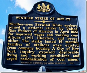
Marker Text: Windber-area Berwind White workers joined a national strike by United Mine Workers of America in April 1922 for improved wages and working conditions, civil liberties, and recognition. The strike lasted 16 months; families of strikers were evicted from company housing. A City of New York inquiry exposed deplorable living and working conditions and urged nationalization of coal mines.

Location:  On Graham Avenue (PA Route 160) and between 13th & 15th Streets in Miner's Park, Windber, Pennsylvania in Somerset County across from the Arcadia Theater near prior marker post “Windber.” Erected by the Pennsylvania Historical and Museum Commission in 2003.

"We are no longer slaves and we are done loading three ton for two. We will never return under a scab system. We want union to protect our rights."
Striking miners at Windber, April 10, 1922

  Similar to my prior posts about the Battle of Blair Mountain and William Blizzard in West Virginia other conflicts between miners and coal companies occurred throughout the U.S. in the early 20th century. A year after the Battle of Blair Mountain, miners in Windber, PA went on strike in 1922 to gain union recognition, preserve their pay rates, and have coal that they dug weighed accurately so they would be paid fairly by the ton.

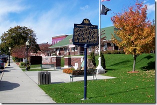
Windber Strike of 1922-23, Miner's Park, Windber, PA

Marker is in Miner’s Park the old train station in background, now a visitor’s center.  Click any photo to enlarge.

  These men were part of a much larger, national strike. Coal operators and the United Mine Workers of America (UMWA) had agreed in 1919 to wage increases and other gains for workers, however, when the contract expired on March 31, 1922, coal operators were determined to roll back any gains. No agreement could be reached, so John L. Lewis, president of the UMWA, led some 610,000 miners out on strike during the first week of April, 1922. This was the first national strike by both anthracite and bituminous miners. The nonunion miners in Windber also fought for the right to have the UMWA bargain collectively for them and to end the autocratic control that the Berwind-White Coal Mining Company had over the mines and the community of Windber.

  UMWA leaders knew that having nonunion miners turn out was critical to winning the strike and the mostly immigrant miners in Windber wanted union help to win union recognition and curb owners power. Most of the miners in Somerset County are Poles, Russians, Slovaks, Hungarians, with a few Welsh and very few Irish. Many of them have been there for many years. In some instances, two generations have been working in these mines and the second generation is just as poor as was the first.

Thursday, December 6, 2012

William Blizzard

William Blizzard marker in Charleston, WV (Click any photo to enlarge)Kanawha County, WV

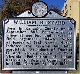
Marker Text: Born in Kanawha County on 19 September 1892. Began work as miner at age ten, and served as field organizer, UMWA. Noted as leader of 1921 Armed March. Indicted for treason but later acquitted. President of District 17 and vice-president of West Virginia Federation of Labor. Retired to Putnam County farm in 1955. Died on 31 July 1958.

Location: In front of UMWA District 17 headquarters, 1300 Kanawha Boulevard East, Charleston, WV. Erected by the West Virginia Division of Archives and History in 2007.

  West Virginia coal miners of the early part of the 20th century often looked to a brash young man named William Blizzard for leadership. Blizzard was an outspoken leader whose name is associated with some of the bloodiest confrontations of West Virginia's mine wars. William Blizzard achieved national prominence as a young man of 29 after the Battle of Blair Mountain, in which miners fought a pitched battle against sheriff's deputies and armed guards.

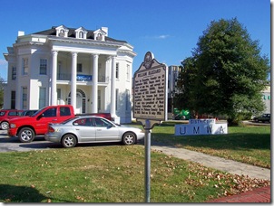
William Blizzard marker in front of UMWA District 17 Headquarters in Charleston, WV

Marker in front of UMWA District 17 headquarters in Charleston, WV.  Click any photo to enlarge.

  Unionist William ‘‘Bill’’ Blizzard was born September 19, 1892, the son of Timothy Blizzard and activist Sarah Rebecca ‘‘Mother’’ Blizzard. He became one of West Virginia’s most influential and controversial labor leaders of the 20th century. Born in the Cabin Creek district of Kanawha County, Blizzard first became involved with the United Mine Workers of America during the bloody Paint Creek-Cabin Creek strike of 1912–13. During the next decade, he rose from the rank and file along with Frank Keeney and Fred Mooney.

  In 1921, Blizzard played a key role in the Miners’ March on Logan County by leading the miners in the front lines of the Battle of Blair Mountain. While District 17 President Keeney and Secretary-treasurer Mooney managed events behind the scenes.

Wednesday, December 5, 2012

Battle of Blair Mountain

BattleofBlairMountainLogan County, WV

Marker Text: In August of 1921, 7000 striking miners led by Bill Blizzard met at Marmet for a march on Logan to organize the southern coalfields for the UMWA. Reaching Blair Mt. on August 31, they were repelled by deputies and mine guards, under Sheriff Don Chafin, waiting in fortified positions. The five-day battle ended with the arrival of U. S. Army and Air Corps. UMWA organizing efforts in southern WV were halted until 1933. "

Location: On WV Route 17, approximately 8 miles east of Logan between Ethel and Blair, WV. Erected by WV Celebration 2000, West Virginia Division of Archives and History in 2002.

  From 2002-2008, I lived in Logan County, WV and I often heard of the stories about the Battle of Blair Mountain from local residents. From the mid-1800's residents in the area knew coal existed in the mountains of Logan County, but it was not until the railroad came to the county in 1904 was it possible to mine the coal for commercial use. Once the railroads made it possible to remove the coal to needed markets the coal business in Logan County took off and the population increased with men seeking employment in the coal mines.

  Prior to the construction of the four lane highway, U.S. Route 119 (or as the locals call it Corridor G) from Logan to Charleston, WV, the only way to travel to Charleston was to go over Blair Mountain on WV Route 17. Traveling over Blair Mountain is not the most difficult mountain road crossing a person can make in West Virginia, but you definitely know you are going over a mountain as you travel the road.

BattleofBlairMountain1

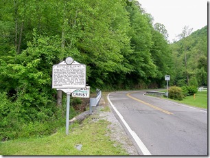
Photo taken looking south on Route 17 toward Logan County. This is where you would go up Blair Mountain from the north.  Click any photo to enlarge.

  The details about the Battle of Blair Mountain, including the events in the coal mines that lead to this confrontation, the lives of the miners, the struggle for unions and the political conditions at the time are so extensive, I cannot possibility cover them in my post on this marker. So I will only give a general description of the events here. If you want to learn more a simple search on the internet, using a search engine, like Google or Bing will give you many links about the details with many interesting photos. A web site by the West Virginia Archives and History has several links to articles about the Battle of Blair Mountain.

Tuesday, December 4, 2012

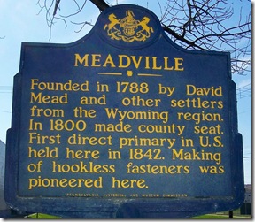
Meadville

Meadville marker location in Meadville, PA - Crawford County (Click any photo to enlarge)Crawford County, PA

Marker Text: Founded in 1788 by David Mead and other settlers from the Wyoming region. In 1800 made county seat. First direct primary in U.S. held here in 1842. Making of hookless fasteners was pioneered here.

Location: On U.S. Route 322 near southern city limits of Meadville, PA. Erected by the Pennsylvania Historical and Museum Commission in 1946.

  Today's marker is about Meadville, PA which is one of many communities which I have a personal fondest. I along with actress Sharon Stone were born here in Meadville, though I never meet her, at least, as far as I know. After graduate school I came back to live in Meadville for about eight years and Meadville was where I meet my best friend and wife. My grandfather operated a garage and gas station in Meadville during the 1950-60's.

  The city of Meadville is the county seat of Crawford County, PA and is about 40 miles south of Erie, PA. It was the first permanent settlement in northwest Pennsylvania. Today, Meadville's population is about 13,388 according to the 2010 census.

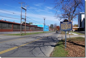
Meadville marker looking toward town, Channel Lock, Inc plant on the left.

Photo taken looking north on Route 322 toward Meadville. Channellock tools company plant is on the left in the photo.  Click any photo to enlarge.

  Meadville was founded on May 12, 1788 by a party of settlers led by David Mead who came from the Wyoming Valley, a region in northeastern Pennsylvania, today it includes the metropolitan areas of Scranton and Wilkes-Barre, PA. Meadville's location was chosen because it lies at the confluence of Cussewago Creek and French Creek and is only a day's travel by boat to the safety of Fort Franklin. Around 1800, many of the settlers to the Meadville area came after receiving land grants for their service in the American Revolutionary War.

Monday, December 3, 2012

Seneca Rocks

Seneca Rocks marker in Pendleton County, WVPendleton County, WV

Marker Text: Seneca Rocks, an outstanding natural formation, rises over 900 feet high, overlooking the junction of the Seneca and Shawnee trails or Warriors' Path and the site of an Indian village with its legend of "Snow Bird", the Indian Princess. The almost perpendicular strata are of Tuscarora Sandstone of the Silurian Age.

Location: On U.S. Route 33 south of junction with WV Route 28. Erected by the West Virginia Historic Commission in 1963.

  If you ever get the opportunity to travel across West Virginia on U.S. Route 33, particularly between Interstate 79 and the Virginia border you will witness some wonderful scenes in West Virginia. When you get to Pendleton County where Route 33 intersects with WV Route 28 you will come to Seneca Rocks. Stopping to view these rock formations is well worth the time. Seneca Rocks and nearby Champe Rocks (further north on Route 28) are the most imposing examples in eastern West Virginia of several formations of the white/gray Tuscarora quartzite. In the early morning mist the jagged outline of Seneca Rocks resembles the bony back of a giant dinosaur.

Seneca Rocks peaks in Pendleton County, WV

View of Seneca Rocks across from the road. Click any photo to enlarge.

  Seneca Rocks is a prominent and visually striking formation rising nearly 900 feet above the confluence of Seneca Creek with the North Fork of the South Branch of the Potomac River. The Rocks consist of a North and a South Peak, with a central notch between. This vast mountain of pale stone provides cliffs and lofty crags inviting exploration by birds, rock climbers, and agile visitors. Seneca Rocks area is part of the Monongahela National Forest.

  The quartzite is approximately 250 feet thick here, located primarily on exposed ridges as caprock or exposed crags. Seneca Rocks is composed of the Tuscarora Sandstone composed of fine grains of sand that were laid down in the Silurian Period approximately 440 million years ago, in an extensive sand shoal at the edge of the ancient Iapetus Ocean, which once covered what is now West Virginia. The Tuscarora Sandstone has been compacted by great pressures into an erosion-resistant rock called a quartz arenite. Now this rock, once seashore sediments, forms high mountains along the entire length of the Appalachians.

Saturday, December 1, 2012

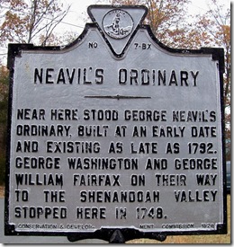
Neavil's Ordinary

BX7NeavilOrdinaryVAFauquier County, VA
Marker No. BX-7

Marker Text: Near here stood George Neavil's Ordinary, built at an early date and existing as late as 1792. George Washington and George William Fairfax on their way to the Shenandoah Valley stopped here in 1748.

Location: At the intersection of County Route 667 (Old Dumfries Road) and County Route 670 (Taylor Road/Old Auburn Road), on Old Dumfries Road near Auburn, VA. Erected by the Conservation & Development Commission in 1928.

  During my travels I have taken many photographs of historical markers related to former Ordinaries as they were called. Many of the markers are referring to Ordinaries which once existed at the location, often during the colonial period of American history. Many of these former Ordinaries no longer exist and the exact location of the Ordinary may have been lost to history. Ordinaries at one time were quite common on the old colonial roads and a welcome sight to the weary traveler. The name Ordinary came over with the earlier settlers who had Ordinaries in England. Ordinaries were also called Public Houses, Inns or Taverns, though I am not sure if there was any difference between them based on the name.

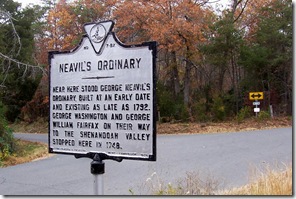
BX7NeavilOrdinaryVA1

The intersection of the two roads in the background.  Neavil’s Mill is located down the road on the left.  Click any photo to enlarge.

  Ordinaries provided a place for the traveler to get food, drink or whiskey. A place to sleep overnight, to stable and feed their horse. Ordinaries were important to the local people who lived nearby, the ordinary became a place to gossip, exchange news with the overnight guests, transact business such as selling land, hold auctions for livestock, pick up mail, and talk politics. Often a place to discuss issues related to independence from England.

  Ordinaries or public houses varied greatly in quality. Some were little more than one-room log cabin or frame buildings with lofts and only a little furniture. Ordinaries offered overnight lodging, but the traveler paid for a place to sleep, not necessarily a private bed. Often a person shared a bed with a total stranger or two.

Thursday, November 29, 2012

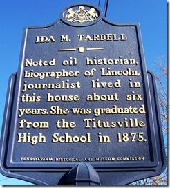
Ida M. Tarbell

IdaMTarbellPACrawford County, PA

Marker Text: Noted oil historian, biographer of Lincoln, journalist, lived in this house about six years. She was graduated from the Titusville High School in 1875.

Location: At 324 East Main Street (PA Route 27), Titusville, PA. Erected by the Pennsylvania Historical and Museum Commission in 1954.

  "Muckrakers" was the name that Theodore Roosevelt gave journalists of the early part of the 20th century who exposed abuses in American business and government. Ida Tarbell, one of the original muckrakers, was able to help shut down the Standard Oil Company monopoly that had hampered her father's efforts in the oil industry in Pennsylvania. Standard Oil founder John D. Rockefeller, irked by her stinging éxpose, dubbed her "Miss Tarbarrel."

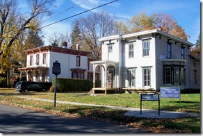
At the time I took the photo in 2009, the Tarbell home was being restored.  Click any photo to enlarge.

  Ida Minerva Tarbell was born in a log cabin on a farm in Erie County, Pennsylvania, on Nov. 5, 1857. Her parents were Franklin S. Tarbell and Esther Ann McCullough Tarbell. When oil was discovered in Pennsylvania, Ida's father became the first manufacturer of wooden oil tanks after oil was discovered not far from this home in Titusville, PA. The Tarbell family first moved to Rouseville, a village on Oil Creek south of Titusville and later to this house in Titusville.

  Ida was still very young when the family moved to Rouseville to take advantage of Pennsylvania's budding oil industry. In school, Ida became fascinated by her science classes. At Titusville conditions were better for the girl, who was sent to good schools and graduated from Titusville High School and later to Allegheny College in Meadville, PA, located west of Titusville in the same county. At Allegheny College she majored in biology, where she received the A. B. degree in 1880, the only woman to graduate in a class of forty and then earned the M. A. degree in 1883.

  After graduation Miss Tarbell taught school for some time at Poland, Ohio, but she was not in her element and found little to challenge her there. She was asked to do some work for The Chautauquan. Eventually she became managing editor of the publication and stayed for eight years.

Wednesday, November 28, 2012

The Civil War/Confederate Cemetery

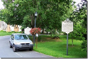
The Civil War marker in Lewisburg, WV - Greenbrier CountyGreenbrier County, WV

Marker Text: (The Civil War) The Greenbrier area was predominately Southern in its sympathies, and furnished some 3000 men for the army of the Confederacy. It was occupied repeatedly by one or the other of the opposing armies throughout the War.

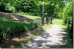
Confederate Cemetery marker in Lewisburg, WV - Greenbrier County(Reverse side – Confederate Cemetery) On the hill, 400 yards west, in a common grave shaped like a cross, lie unclaimed bodies of ninety-five Confederate soldiers, casualties of the area, including those of the Battle of Droop Mountain and the Battle of Lewisburg.

Location: On U.S. Route 60 (westbound) off of W. Washington St. on Courtney Drive in New River Library Park, Lewisburg, WV, grouped with another marker called “Lewisburg.”  Erected by the West Virginia Historic Commission in 1963.

"The town was filled to overflowing with sick and dying men. Every public building in the place was converted to their service. The pews were taken up in the lecture room of the (Old Stone) church, and its aisles filled with double rows of cots. The Academy, the Masonic Hall, the hotels, offices, and private dwellings were filled to overflowing." - Rose W. Fry

The Civil War/ Confederate Cemtery marker in Library Park, Lewisburg, WV  Confederate General Robert E. Lee, with Wise and Floyd, had been in the Kanawha Valley during 1861. Now in 1862, Federal troops forces held this region in what is now West Virginia, which as rich in salt, a prized commodity during the Civil War. In 1862 the South was anxious to regain the valley, and the North wanted to carry the war across the mountains into central Virginia. Lewisburg, WV was in the middle of these military goals.

Path to entrance to the Confederate Cemetery, Lewisburg, WV

Path to entry to cemetery from the parking lot. Two markers are in front of the fence.  Click any photo to enlarge.

  Early in June, 1861, Confederate General Henry A. Wise passed down the Kanawha Valley and General Floyd was also sent into this region. In September, 1861, Gen. Robert E. Lee with 10,000 men marched down from the northwest through Lewisburg and on to Sewell Mountain to encounter Gen. Rosecrans' force under Gen. Cox, who had command in the Valley. When winter set in, the Union troops withdrew and Gen. Lee's troops also departed. Many of Lee's wounded were nursed in Lewisburg.

  Though armies on both sides passed through Lewisburg throughout the Civil War, on May 23, 1862, the citizens of Lewisburg would not be spared the horrors of war on their doorsteps during and after the Battle of Lewisburg. Lewisburg citizens would pass on for generations stories of the day the battle was fought in the streets of the town.

Tuesday, November 27, 2012

Hatfield and McCoy Markers on HMdb

Devil Anse Hatfield grave marker in Logan County, WV  I have taken thousands of photographs of historical markers in several states over the years.  I have enough photos to keep me busy posting on my own blog for the next several years.  Therefore, I also contribute photos to the Historical Markers Database, which is a web site dedicated to collecting photos and information about all the historic markers in the United States and other countries using volunteers throughout the U.S.

  Each week their web site highlights a particular historica marker of interest.  This week they highlighted the “Hatfield Cemetery” marker which I contributed photographs as well as posting the Hatfield and McCoy markers on my blog here.  The “Hatfield Cemetery” marker is the second most visited marker viewed on their web site this year with over 14,000 views.  The number of views both on their web site and my blog is due in large part to the History Channel’s series on the feud.  I also contributed all of the markers related to the Hatfield and McCoy feud appearing on the Historical Marker Database so far.

  You can check out the markers, I posted there by following the above link or you can check out my posts by following the links related to categories for “Hatfield and McCoy Feud” on the right of my blog posts.

Monday, November 26, 2012

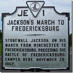
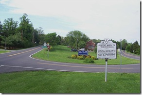
Jackson's March to Fredericksburg

Jackson's March To Fredericksburg, marker JE-1, Madison Co. VAMadison County, VA
Marker No. JE-1

Marker Text: Stonewall Jackson, on his march from Winchester to Fredericksburg, preceding the battle of Fredericksburg, camped here, November 26, 1862.

Location: At the intersection of Business U.S. Route 29 (North Main Street) and Virginia Route 231 (Old Blue Ridge Turnpike), north of Madison, VA. Erected by the Conservation & Development Commission in 1929.

  On November 24, 1862, 150 years ago, Confederate General Thomas “Stonewall” Jackson's Second corps of about 25,000 men began their march to cross the Blue Ridge Mountains using Fisher's Gap within the bounds of present day Shenandoah National Park on the way to Fredericksburg. By the evening of November 26, Jackson's Army had reached this point north of Madison, VA and about 6.5 miles south of the previous camp location where a previous marker was covered yesterday is located.

Jackson's March To Fredericksburg, marker JE-1, at intersection with Routes 29 & 231, Madison, VA

In photo Route 231 is on the left traveling north and Business Route 29 is on the right looking northbound. Going north on Route 231 would take you to the site of yesterday's marker. Click any photo to enlarge.
  According to sources, it took Jackson's army four days to move over the Blue Ridge Mountains with all their men and equipment. Based on this information, only a part of Jackson's army would have camped here, while other parts of the army was camping at yesterday's location and while still others were camped at a location on the west side of the mountain.

  Once all of the army had moved over the mountains, then their rate of travel to Fredericksburg would have increased considerably. Stonewall Jackson's army arrived at Lee's headquarters on November 29 and his divisions were deployed to prevent Gen. Ambrose Burnside from crossing downstream from Fredericksburg.

Sunday, November 25, 2012

A Camp of Stonewall Jackson's

A Camp of Stonewall Jackson's, Madison County, VA Marker JE-15Madison County, VA
Marker No. JE-15

Marker Text: Just to the north, on the night of November 25, 1862, Stonewall Jackson, with his corps, camped. He was on his way to join Lee at Fredericksburg.
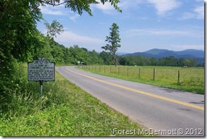
Location:  On Route 670 (Old Blue Ridge Turnpike) just south of County Route 649 (Quaker Run Road), one mile north of Criglersville, VA. Erected by the Conservation & Development Commission in 1930.

“Near the top, as we were marching, there was a rock, and looking back and down the road, we could see six lines of our army; in one place infantry, in another artillery, in another ambulances and wagons. Some seemed to be coming towards us, some going to the right, some to the left, and some going away from us. They were all, however, climbing the winding mountain road, and following us.” - quote by Private John H. Worsham of the 21st Virginia Infantry who later wrote of the armies crossing through Fisher's Gap.

A Camp of Stonewall Jackson's, on Route 670, Madison Co. VA Marker JE-15

Photo taken looking north on Route 670. Mountain that Jackson’s army traveled over is in the background to the right.  Click any photo to enlarge.

  Throughout Virginia, a person will discover almost countless numbers of historical markers related in some way to Confederate General Thomas “Stonewall” Jackson. Many of the markers relate to U.S. Civil War engagements and battles which he and his troops participated. Some markers, like today, simply mention that his army camped at a particular location exactly 150 years ago, while others may simply indicate that his army crossed the road.

  Stonewall Jackson's army had crossed the Blue Ridge Mountains, several times during the Civil War from the Shenandoah Valley to the Piedmont region of Virginia. Crossing the Blue Ridge Mountains, even using the variety of gaps that existed was not easy for an individual, but to do it with a whole army of 25,000 troops and equipment must have been an amazing accomplishment.

Saturday, November 24, 2012

Fredericksburg Campaign

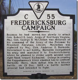
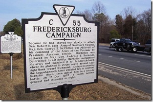
Fredericksburg Campaign, Fauquier County, VA Marker C-55Fauquier County, VA
Marker No. C-55

Marker Text: Because he had moved too slowly to attack Gen. Robert E. Lee's Army of Northern Virginia, Maj. Gen. George B. McClellan was relieved of his command of the Army of the Potomac by President Abraham Lincoln. McClellan was replaced by Maj. Gen. Ambrose E. Burnside. Determined to act boldly, Burnside reorganized his army and marched it to Fredericksburg, where he planned to strike south around Lee's right flank toward Richmond. Delays in crossing the Rappahannock River enabled Lee to confront Burnside there, then defeat him in a bloody battle on 13 Dec. 1862 - a battle neither general had intended to fight.

Location: At the intersection of U.S. Route 29 (Lee Highway) and County Route 605 (Colonial Road/Dumfries Road), on the west side of Lee Highway north of Warrenton, VA. Grouped with marker C-9 (McClellan's Farewell). Erected by the Department of Historic Resources in 1997.

  Today's marker is grouped with a related marker at the same location called “McClellan's Farewell,” subject of an earlier post this month. As one commander of the Army of the Potomac says farewell to the army, the same location begins the military plans of the new commander, Maj. Gen. Ambrose E. Burnside. Burnside wants to demonstrate to President Abraham Lincoln that he was chosen a capable general, unfortunately as the Battle of Fredericksburg unfolds this would prove false.

Fredericksburg Campaign, on Route 29 north of Warrenton, VA Marker C-55

Photo taken looking north on U.S. Route 29.  Click any photo to enlarge.

  In November 1862, President Abraham Lincoln needed to demonstrate the success of the Union war effort before the public lost confidence in his administration. Confederate armies had been on the move earlier in the fall, invading Kentucky and Maryland, and although each had been turned back, the Confederate armies remained intact and capable of further action. Lincoln urged Maj. Gen. Ulysses S. Grant to advance against the Confederate stronghold of Vicksburg, Mississippi. Maj. Gen. George B. McClellan had stopped Confederate General Robert E. Lee at the Battle of Antietam in Maryland, but had not been able to destroy Lee's army, nor did he pursue Lee back into Virginia aggressively enough for Lincoln.

Friday, November 23, 2012

Daniel Boone

Daniel Boone marker, Kanawha County, WV (Click any photo to enlarge)Kanawha County, WV

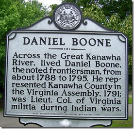
Marker Text: Across the Great Kanawha River, lived Daniel Boone, the noted frontiersman, from about 1788 to 1795. He represented Kanawha County in the Virginia Assembly, 1791; was Lieut. Col. of Virginia militia during Indian wars.

Location: On U.S. Route 60, in Daniel Boone Park, east of Charleston, WV. I have photographed the marker twice, the second time the marker had been refurbished and moved further west of its original location in the park. Erected by the West Virginia Department of Culture and History in 1979. This marker is located near the prior post of the “Craik-Patton House” within the same park.

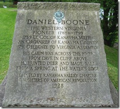
  Another stone memorial marker is located across the park road from the state marker, notice the dates on each marker do not match.

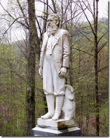
Daniel Boone stone monument in the Daniel Boone ParkDaniel Boone
The Western Virginia
Pioneer 1788-1799
1789 Lt. Col. Of Kanawha Militia
An Organizer of Kanawha County
1791 Delegate to Virginia Assembly
His Cabin was Across the River
from Cave in Cliff Above
He hunted Deer and Made Salt
From a Spring at the Water's Edge
Erected by Kanawha Valley Chapter Daughters of American Revolution
1928

  After you travel around and take photos of a couple of thousand historical markers, you begin to see some trends develop, particularly in regard to specific individuals. One such individual is Daniel Boone. Daniel Boone was one of those bigger than life American frontiersmen and his name appears on many historical markers related to early American history. For example, he is mentioned in yesterdays marker in Kentucky in references to Boone's Road and Boonesborough, KY. and in a prior post called, “Lincoln's Virginia Ancestors.” Daniel Boone traveled a great deal for a person of this period in history and markers throughout several states record those specific moments in his life and our nation.

  Today's marker is simply titled, “Daniel Boone” and I have found about sixty markers with his name in the title of the marker and about 80 or more containing his name in the text. These numbers are probably a conservative estimate and there are most likely many more. In researching some markers I have discovered that Daniel Boone was apart of the underlying story, but he was not mentioned in the marker text itself.

Thursday, November 22, 2012

Wilderness Road/Logan’s Station

Wilderness Road, Marker 2177 (Side 1) Stanford, KY (Click any photo to enlarge)Lincoln County, KY
Marker Number 2177

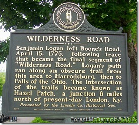
Marker Text: Benjamin Logan left Boone’s Road, April 15, 1775, following trace that became the final segment of “Wilderness Road.” Logan’s path ran along an obscure trail from this area to Harrodsburg, then to Falls of the Ohio. The intersection of the trails became known as Hazel Patch, a junction 8 miles north of present-day London, Ky.

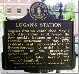
Logan's Station, Marker 2177 (Side 2) Stanford, KY (Click any photo to enlarge)(Reverse side) Logan’s Station established May 1, 1775. Also known as St. Asaph, the fort quickly became an important frontier settlement. In May 1775, residents sent representatives to Boonesborough to assist in the formation of the proprietary government of Transylvania. Logan’s Fort later became the town of Stanford.

Location: On Main Street, U.S. Route 150, at intersection with Lancaster Street at northwest corner of the Lincoln County Courthouse in Stanford, KY. Presented by the Lincoln Co. Historical Soc. and erected by the Kentucky Historical Society, Kentucky Department of Highways in 2005.

Wilderness Road marker in front of the Lincoln Co. Courthouse, Stanford, KY

Marker is at the corner of the location of the Lincoln Co. Courthouse in the background.  Logan Station text on opposite side.  Click any photo to enlarge.

  As you read historical road markers, you come to realize that most communities exist today due to factors related to transportation or defense. The site selection of a community was decided based on an early road, canal, railroad, river or need for defense. Today's marker addresses two of those factors, the Wilderness Road which helped in the settlement of Kentucky and one of the forts for protection along that road.

  With the Appalachian Mountains reaching roughly north and south formed a natural barrier making travel east–west difficult. Settlers from Pennsylvania tended to migrate south along the Great Wagon Road through the Great Appalachian Valley and Shenandoah Valley. Daniel Boone was from Pennsylvania and migrated south with his family along this road.

Wednesday, November 21, 2012

Edgar Allan Poe

Edgar Allan Poe marker Q-29, Charlottesville, VA (Click any photo to enlarge)Marker No. Q-29
Charlottesville
Albemarle County, VA

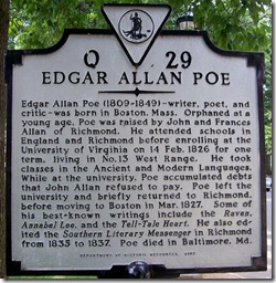
Marker Text:  Edgar Allan Poe (1809-1849) – writer, poet, and critic – was born in Boston, Mass. Orphaned at a young age, Poe was raised by John and Frances Allan of Richmond. He attended schools in England and Richmond before enrolling at the University of Virginia on 14 Feb. 1826 for one term, living in No. 13 West Range. He took classes in the Ancient and Modern Languages. While at the university, Poe accumulated debts that John Allan refused to pay. Poe left the university and briefly returned to Richmond, before moving to Boston in Mar. 1827. Some of his best-known writings include the Raven, Annabel Lee, and the Tell-Tale Heart. He also edited the Southern Literary Messenger in Richmond from 1835 to 1837. Poe died in Baltimore, Md.

Location: On McCormick Road, next to Poe Alley on the campus of the University of Virginia. Erected by the Department of Historic Resources in 2003.

“Deep into that darkness peering, long I stood there, wondering, fearing, doubting, dreaming dreams no mortal ever dared to dream before.” - Edgar Allan Poe

  When I stop to look and photograph an historical markers, I am always surprised by the things I learn I never knew. While in Charlottesville for a doctor's appointment I drove through the University of Virginia campus and found this marker about Edgar Allan Poe. I had not realized he had lived in Virginia and went to school here for a short time.

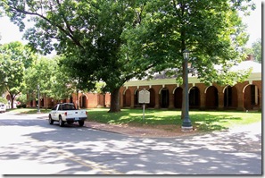
Edgar Allan Poe marker Q-29, on campus of University of Virginia.

Poe’s room is in the building to the right of the marker.  Click any photo to enlarge.

  The marker is located in front of the place where Poe resided. Poe's room was Number Thirteen, West Range, and is now used as a memorial to him. I did not realize this at the time or I would have taken a photo of the room as well, but links to photos of the room are below.

  Poe entered as a student on St. Valentine's Day, February 14, 1826 while the second session at the University was already under way. The university had only began to accept students for classes in 1825 though the university was formally founded in 1819. Thomas Jefferson, the university's founder and whose home Monticello overlooked the university was still alive when Poe arrived. Poe mentions in one of his letters to John Allan from the university that the Rotunda was yet unfinished, and that books had just been removed to the library. According to some accounts I had read, Poe did get to meet Jefferson and on one occasion had lunch with Jefferson and other students.

Thursday, November 15, 2012

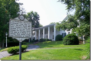
Lewisburg Battle

Lewisburg Battle marker, Greenbrier County, WV (Click any photo to enlarge)Greenbrier County, WV

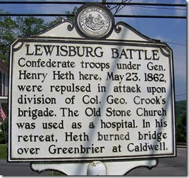
Marker Text: Confederate troops under Gen. Henry Heth here, May 23, 1862, were repulsed in attack upon division of Col. Geo. Crook's brigade. The Old Stone Church was used as a hospital. In his retreat, Heth burned bridge over Greenbrier at Caldwell.

Location: On U.S. Route 60 (eastbound) at corner of Lee and Washington streets; in front of General Lewis Hotel.

"Of all the battlefields that I have studied, I know of none quite so dramatic as Lewisburg (where the battle was), fought in a mountain town, before breakfast, and combining rifle shooting, artillery fire, infantry charges, and cavalry, all in a sleeping little city whose inhabitants awoke to hear the cannon boom and the rifles speak, and who had no time to do anything in the way of escape until it was all over." Quote by Andrew Price, local historian.

  The Battle of Lewisburg occurred on the same day as the Battle of Front Royal, VA on May 23, 1862. The Battle of Lewisburg, a Union victory, occurred as Union troops under the command of Col. George Crook maneuvered from Western Virginia toward Tennessee in the spring of 1862. Union Gen. John C. Frémont, commander of the Mountain Department for the U.S. Army, planned to concentrate his forces in Monterey, Virginia, and then move southwest until he reached the Virginia & Tennessee Railroad near Christiansburg. There, Frémont was to connect with troops under the command of Union Gen. Jacob D. Cox, but Frémont was detained further north in the Shenandoah Valley due to the Valley Campaign of Confederate Gen. Thomas “Stonewall” Jackson in the spring of 1862.

Lewisburg Battle marker, in front of Gen. Lewis Hotel, (Click any photo to enlarge)

The marker is located in front of the General Lewis Hotel in the background and most of the battle occurred at this location.  Click any photo to enlarge.

  Gen. Cox, unaware that Frémont’s troops would not arrive as planned continued with his plans. Three of Cox's four brigades occupied Princeton, VA (now in West Virginia), a town that had been lost to Confederate forces earlier in May 1862, his fourth brigade, under the command of Col. George Crook, moved to Lewisburg. From his position Crook and his 1,600 men were within supporting distance of the troops located in Princeton, but also unknowingly vulnerable to attack from Confederate Brig. Gen. Henry Heth's 2,200 men.